Data Visualization & Infographics
A People's Guide to New York City
Antipsychotics in U.S. Nursing Homes
Calendar of Killings by Police
Conflict Dynamics around Refugee Settlements in Northern Uganda
Data Visualization and Human Rights
Executions and disappearances in Punjab
Gold Trade in the Democratic Republic of Congo
Human Rights Watch World Report 2005
Journalists Imprisoned in China
Kardze Tibetan Autonomous Prefecture
Nigeria School Attacks Timeline
Policing Poverty and Racial Inequality in Tulsa
Selected CIA Aircraft Routes and Rendition Flights 2001-2006
Stephens, Catherwood, and Katz
Timeline of Boko Haram Abductions
Visualizing Data for Human Rights Advocacy
Visualizing Information for Advocacy: An Introduction to Information Design
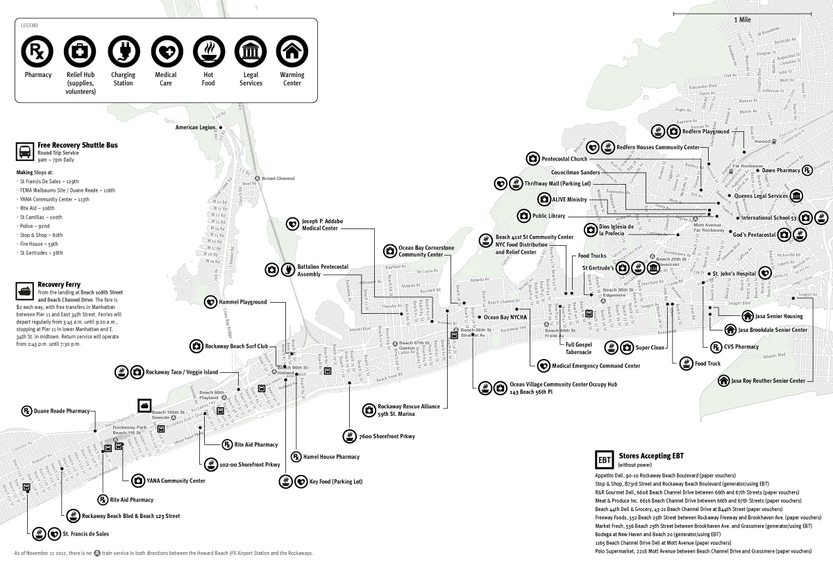
Rockaways Emergency Map
After Hurricane Sandy devastated the Rockaways in 2012, I collaborated with members of OccuPrint to produce an emergency map showing relief and transportation services in the area. These were printed in a 12-page bulletin along with sections on how to apply for disaster-related unemployment benefits, how to clean floodwater, how to work with the Federal Emergency Management Agency, and a word search and sudoku puzzle. These were distributed for free throughout the affected areas. Click to download a PDF.