
17 September 2006
Mapping the “War on Terror,” 3
A billboard I designed is up on display in Los Angeles. It’s part of a series of public art installations about the war, and will be on view until October 8, 2006.
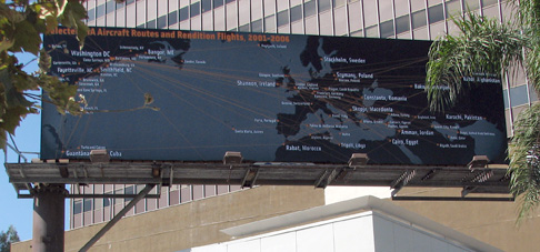
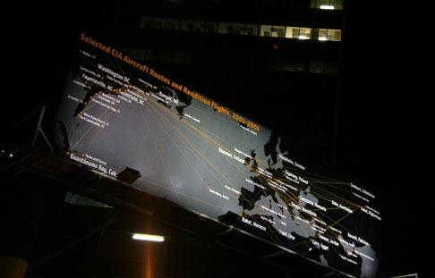
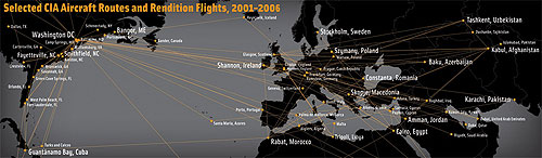
The image is a map of Selected CIA Aircraft Routes and Rendition Flights 2001-2006, some of which transported prisoners to foreign countries to be interrogated and tortured. After years of silence and denial, the administration publicly acknowledged the flights in the last few weeks.
I worked with artist and geographer Trevor Paglen who provided the data. Trevor spent several years tracking down the flight information, and has a book out this month on his investigations, Torture Taxi: On the Trail of the CIA’s Rendition Flights. See this interview with him on Democracy Now! with co-author, journalist A.C. Thompson.
The billboard is located at 6150 Wilshire Boulevard, near South Fairfax Ave, between Beverly Hills and West Hollywood. Here’s a Google Map.
Clockshop, a public arts organization in Los Angeles, funded the display. You can read more about the project at http://clockshop.org/here.php
A few images, below: