

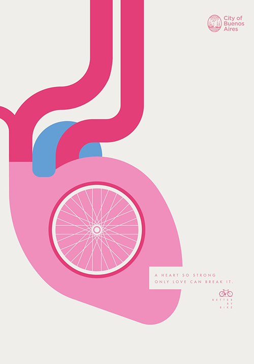
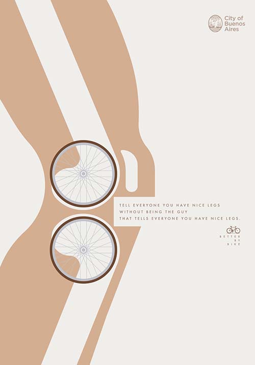
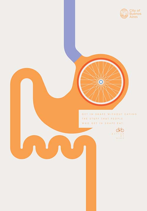
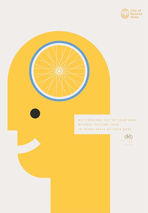
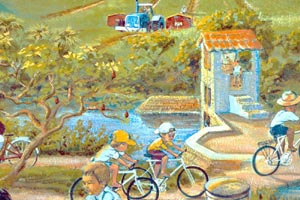
bicycles
Making Passes
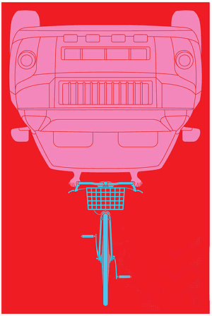
Cute urban intervention from bicycle advocacy group Critical Mass in Hungary:
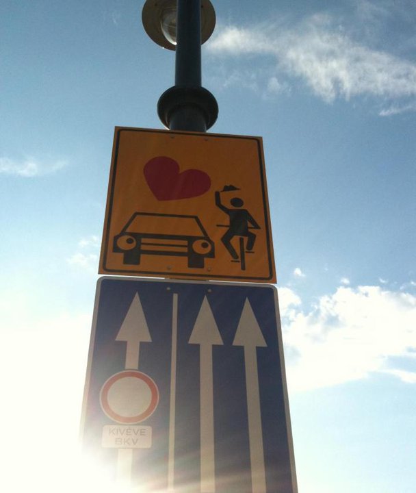
Related: this sticker I caught in Brooklyn.
Ghost Bikes
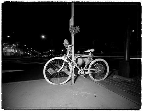
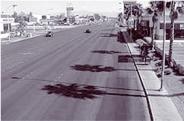
Last week, the New York Times ran a sober photo essay on the ghost bikes that Visual Resistance and Time’s Up! have been installing around New York City since June 2005. The bikes are public interventions, a grassroots action in the spirit of graffiti memorial walls. The bikes are painted white and chained near the site where a cyclist was killed by an automobile, along with a plaque with their name and the date they were killed. Several are plotted on this map.
The bikes were inspired by a similar project in St. Louis, and have since appeared in cities across the U.S. and the U.K.
A 2005 report on bicycle fatalities from the New York City police, parks, health, and transportation departments reports that between 1996 and 2005, 225 bicyclists were killed in crashes with motor vehicles. Between 1996 and 2003, 3,462 NYC bicyclists were seriously injured in crashes.While the annual number of serious injuries has decreased, deaths remained steady during the 10-year period.
The statistics show a failure of urban design and policy — 89% of crashes occurred at or near intersections, 92% of bicyclist fatalities resulted from crashes with motor vehicles — as well as the absence of personal equipment: 97% of the bicyclists who died were not wearing a helmet. 74% of the fatal crashes involved a head injury.
While it’s clear that helmets save lives, something else is broken in NYC: of the 3,964 transportation-related deaths in New York City between 1996 and 2005, only 6% were cyclists. Almost half the deaths (49%) were pedestrians.
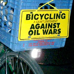
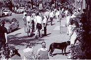
Call for Artwork: Critical Mass
 The daughter of a friend was arrested during the Republican National Convention. Her crime: riding her bicycle.
She was one of 5,000 people who rode with Critical Mass that clear August evening, and one of 250 arrested. She spent 25 hours in jail for riding her bike in support ecology, fewer cars, and a more bicycle friendly city.
“She lost a bit of innocence that summer,” says her mom.
Since the RNC, the New York Police Department have continued their campaign of intimidation and harassment, arresting riders and seizing bikes despite a court order. Now the Department is suing Time’s Up!, a nonprofit environmental group, to prevent them from participating in and promoting the rides and to enforce the ban on assembly of 20 or more people in a park without a permit.
The folks at Visual Resistance are facilitating a street art campaign in support of Critical Mass and are calling for designs. They hope to produce materials before the April 29th ride.
They will make the designs available for download and have a few printed. Some suggested themes include supporting/promoting Critical Mass; defending the right to free assembly; and promoting bicycling as a form of transportation.
For more info on Critical Mass and harassment by NYPD, visit the Time’s Up press room.
Poster designs should be 8.5x11 or 11x17 inches, sticker and stencil designs can be any logical size. Find out more.
Where the Sidewalk Ends
A paper in the September issue of the American Journal of Public Health, “Promoting Safe Walking and Cycling to Improve Public Health: Lessons From The Netherlands and Germany” by a couple of researchers in New Jersey and Brussels examines:
“The public health consequences of unsafe and inconvenient walking and bicycling conditions in American cities to suggest improvements based on successful policies in The Netherlands and Germany.”
What they found:
 “Cyclists and pedestrians in the United States were two to six times more likely to be killed than their German or Dutch counterparts. Per kilometer traveled, U.S. pedestrians were 23 times more likely to get killed than the occupants of a car, while bicyclists were 12 times more likely to be killed.” [source]
With this in mind and my previous post on the link between sprawl and obesity, I note that on July 24, the House Appropriations Committee voted a transportation appropriations bill out of committee that eliminates funding for the Transportation Enhancements program.
Since 1991, 10% of federal funds distributed to states through the Surface Transportation Program has been reserved for transportation enhancement activities. This meant roughly $600 million a year of federal funding for locally driven, pedestrian centered projects.
“Congress established the TE program in 1991 as a commitment by Congress to constituents that a small percentage of their gas tax dollars would be targeted to small-scale, community-initiated, locally selected transportation projects such as multi-use paths, pedestrian and bicycle facilities, historic preservation, and improvement of streetscapes and landscapes.” [source]
“Since its inception, the TE program has provided $6 billion to support 16,699 projects nationwide, including thousands of historic preservation projects. Now, Congress is acting to reverse this decade-long community building program and return to a regressive ‘roads-only’ policy.” [source]
The Rails-to-Trails Conservancy has posted a detailed state-level breakdown of projects funded under Transportation Enhancements program.
H.R. 2989, the Transportation and Treasury Appropriations Bill for 2004, actually increases highway spending to $34.1 billion — $6.1 billion more than 2003 and $4.5 billion more than President Bush’s request.
There is still hope, but we must act now. Before the full House votes on the bill it can still be amended. Congress resumes after Labor Day and is expected to vote on the bill in early September.
An amendment removing section 114 from H.R. 2989 would grant approximately $812 million to the Transportation Enhancements program. Unless reversed, individual states would be allowed to put all funds into highway projects instead of setting aside the 10% now reserved for bicycle and pedestrian projects.
See these action alerts to learn more, for contact information and talking points.
With all that’s going on, the issue is probably not high on everyone’s social justice agenda. But there’s an immediate and brief opportunity to save this great program right now.
UPDATE: On September 4 the House approved an amendment which strikes section 114 from the bill — restoring funding for the Transportation Enhancements program to the appropriations bill. On September 9, the House passed the full appropriations bill and sent it to the Senate. Thanks to everyone for taking action!
Sprawl Linked to Obesity
 From the press release:
“A new national study and special issues of two prestigious medical journals released today offer powerful indications that sprawling development has a hand in the country’s obesity crisis. Together, they demonstrate the urgent need to invest in making America’s neighborhoods appealing and safe places to walk and bicycle. The peer-reviewed study, which used a county sprawl index developed in partnership with Smart Growth America, found that people living in automobile-dependent neighborhoods that suppress walking do indeed walk less, weigh more, and are more likely to suffer from high blood pressure. The study, Relationship between Urban Sprawl and Physical Activity, Obesity, and Morbidity is being published in a special issue of the American Journal of Health Promotion. Smart Growth America and the Surface Transportation Policy Project have issued a companion report, Measuring the Health Effects of Sprawl, which gives county-level data illustrating the findings for the metropolitan areas studied. In most metropolitan areas, residents in more sprawling counties are heavier and face higher odds of being obese and having high blood pressure than those in less sprawling counties... The report outlines seven steps communities can take to respond to the findings of the research.”
The paper was presented at the 11th annual Congress for the New Urbanism, an organization that pushes for all new development in the United States to be more compact and walkable.
 The metropolitan sprawl index:
“uses 22 variables to characterize four ‘factors’ of sprawl for 83 of the largest metropolitan area in the US for the year 2000. The sprawl ‘scores’ for each metropolitan area show how much they spread out housing, segregate homes from other places, have only weak centers of activity, and have poorly connected street networks.... The county sprawl index uses six variables from the US Census and the Department of Agriculture’s Natural Resources Inventory to account for residential density and street accessibility.”
The sprawl index of 448 counties was compared to body mass index and data on average weight drawn from the Centers for Disease Control and Prevention.
Research into other factors, such as linking location to what and how much people eat, and analysis at the neighborhood level is forthcoming.
Obesity in the United States is at an all time high. More than two-thirds of adults are overweight and nearly 1 in 3 are obese. Obesity is rapidly catching up to tobacco use as the leading cause of death. [source]
via Planetizen
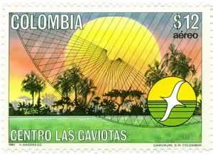
Gaviotas
In 1965 Paulo Lugari was flying over the impoverished Llanos Orientales, the “eastern plains” that border Venezuela. The soil of the Llanos is tough and acidic, some of the worst in Colombia. Lugari mused that if people could live here they could live anywhere.
The following year Lugari and a group of scientists, artists, agronomists and engineers took the 15-hour journey along a tortuous route from Bogota to the Llanos Orientales to settle. The local population, including the indigenous Guahibo people, familiar with the political terror and violence of the ‘white man,’ were naturally suspicious.
Nearly 40 years later, while war rages across Colombia with the help of U.S. funds, equipment, and training, the 200 residents of Gaviotas, including farmers, scientists, artists, and former street kids, have created a thriving village and environmental research center in Vichada in Los Llanos.
“Gaviotas is named after a bird that enlivens the rivers at dusk.” [source]
“They have planted millions of trees, thus regenerating an indigenous rainforest. They farm organically and use wind and solar power. Every family enjoys free housing, community meals, and schooling. There are no weapons, no police, no jail. There is no mayor.” [source]
“Gaviotas provided a chance to plan a tropical civilization from the ground up, instead of depending on technologies developed for northern climates. ‘When we import solutions from the US or Europe,’ said Lugari, founder of Gaviotas, ‘we also import their problems.’
Over the years Gaviotas technicians have installed thousands of the windmills across Colombia - in some places gaviotas is the local word for windmill.”
Around 58 types of windmill were tried and tested before the pioneers came up with determined that the distinctive ‘sunflower’ design functioned best in the plains.
 “Since Gaviotas refuses to patent inventions, preferring to share them freely, the design has been copied from Central America to Chile.
Electricity comes from a low-head turbine powered by a stream, except in the short dry season, when it is backed up by a diesel generator. ‘In 24 years we’ve learned to cover 70 percent of our food and energy needs,’ says Gonalo Bernal, administrator of Gaviotas. ‘The trees we plant more than compensate for any greenhouse gases we emit. Imagine if the rest of the world lived like us.’
Gaviotas began as a collection of researchers, students, and laborers sharing vehicles, bedding, dishes, clothes - and decisions. In time several of their families joined them and a permanent colony with individual houses emerged. Government was by consensus and unwritten rules. To limit public disorder, alcohol is confined to homes. To preserve wildlife, dogs and guns are banished. A need for police, jail, or door locks has never arisen. Anyone who violates protocol, like a storekeeper who recently admitted to overcharging, is ostracized by the community until his debt is paid. Loafers aren’t tolerated, but with wages above the Colombian minimum wage, plus free meals, medical care, schools, and housing, loafing isn’t a problem.
A techno-tour of the llanos shows how Gaviotas has revolutionized life here. The most significant invention is a simple hand pump capable of tapping aquifers six times deeper than conventional models, but requiring so little effort that children can operate it. In normal pumps a heavy piston must be raised and lowered inside a pipe. Gaviotas engineers realized they could do the reverse; leave the piston stationary and lift an outer sleeve of lightweight, inexpensive PVC tubing instead.”
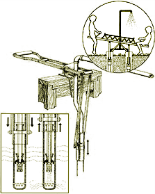 “In the open-air Gaviotas preschool, the children’s see-saw is actually a pump in disguise. As they rise and descend, water gushes from a vertical pipe into an open cement tank. Over the years Gaviotas technicians have installed these in thousands of school yards, using kid power to provide villages with clean water. This simple, inexpensive pump has revolutionised rural life across Colombia for people who used to haul their water in buckets from muddy tropical rivers.” [source]
“At a windmill-fed cattle trough, surrounded by a sloping cement floor, cowboys have just brought several thirsty calves. As they drink, their dung slides down the slope into a gutter, which sluices it to an enclosed anaerobic fermentation tank, where the cow-pie slurry turns into compost and methane.
The methane flows through pipes to the 16-bed Gaviotas hospital, which a Japanese architectural journal has named one of the 40 most important buildings in the world. It is at once both futuristic and ancient, a maze of angles formed by white walls, glass awnings, skylights, brushed steel columns, and exposed supports trimmed in blue and yellow enamel. The interior is cooled with underground ducts whose hillside intakes face the prevailing breeze. Opposing layers of corrugated roofing create a series of air channels that further bleed away the heat. The combined effect is cost-free, maintenance-free air conditioning. Solar collectors on the roof alternately heat, boil, and distill water. Electricity is from solar photovoltaic cells.
The only hospital within a 12-hour radius, it serves all comers, including both guerrilla and army forces battling in the area. ‘The rule here is never to ask,’ says Bernal. ‘Like the Red Cross, everybody respects us.’
A short, vine-covered walkway connects the Gaviotas hospital to the maloks, a separate wing built by the local Guahivo Indians. Instead of beds, patients and their families lie in hammocks hung from wooden beams under a great thatch roof. Relatives of the sick tend crops of tomatoes, lettuce, and onions in an adjacent hydroponic greenhouse.
If the National University’s pharmacology department and the Guahivo shamans have their way, this greenhouse will one day become the finest medical plant laboratory in the tropics. But money is a critical factor, and Colombia’s expanding, government-owned oil and gas industry has dampened Gaviotas’ solar collector sales by blocking tax benefits for investing in alternative energy. At  the same time revenue from windmills and pumps dropped as Colombian agriculture was battered by an unexpected onslaught of cheap imported foods, the fallout of new free trade policies.
So Gaviotas has decided to scale down its manufacturing. But no one is getting laid off. ‘Gaviotas isn’t a company,’ Lugari says, ‘we’re a community. In fact the solution means that both employment and Gaviotas will grow.’
The solution is the nearly 20,000 forested acres. In the past 12 years, Gaviotas has planted 1.6 million Caribbean pines (after finding that no indigenous tree would grow on the prairie). To the surprise of foresters, Gaviotans chose not to cut their standing timber. Instead they are converting their windmill factory to process pine resin. Colombia spends $4 million annually to import such resins for the manufacture of paint, turpentine, and paper. Armed with that fact, Lugari persuaded the Japanese government to provide the seed money, via a grant through the Interamerican Development Bank, to begin tapping and processing resin for the domestic market.” [source]
Since the above was written in 1995, the community no longer purhcases diesel fuel and is now totally energy independent. They generate power with turbine engines fueled by the resin of the Carribean pine trees in their forest. These pines are being slowly crowded out by the regeneration of indigenous rainforest. [source]
Other inventions include:
- a high pressure solar cooker
- methane burners
- hot-water solar panels
- parabolic solar grain driers
- self-cooling rooftops
- cooling wind corridors
- corkscrewing manual well digger
- variety of highly efficient and durable windmills
- specialized bicycle for the Llanos
- pedal powered cassava grinder (10 hours work done in 1 hour)
- rotating drum peanut sheller
- ox-drawn land graders
- one-handed sugarcane press
Gaviotas engineers also designed a solar kettle for the hospital. According to engineer Jaime Dávila, “the principle begins with an old country custom: boil water one day to drink the next, after it cools.” Dávila’s goal was an inexpensive solar-operated system that would give unlimited boiled drinking water, already cooled to room temperature, straight from a tap any time of day, and would work under cloudy skies. The kettle took six years to perfect. It combines solar panels, storage tanks, an efficient heat exchanger, a bit of distillation and a spigot — which you turn to draw off potable water.[source]
See some renderings of their solar collectors, solar oven, and wind-powered musical organ.
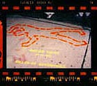
Routing
  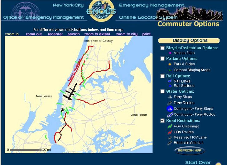 Click for a full size view. |
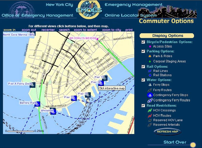
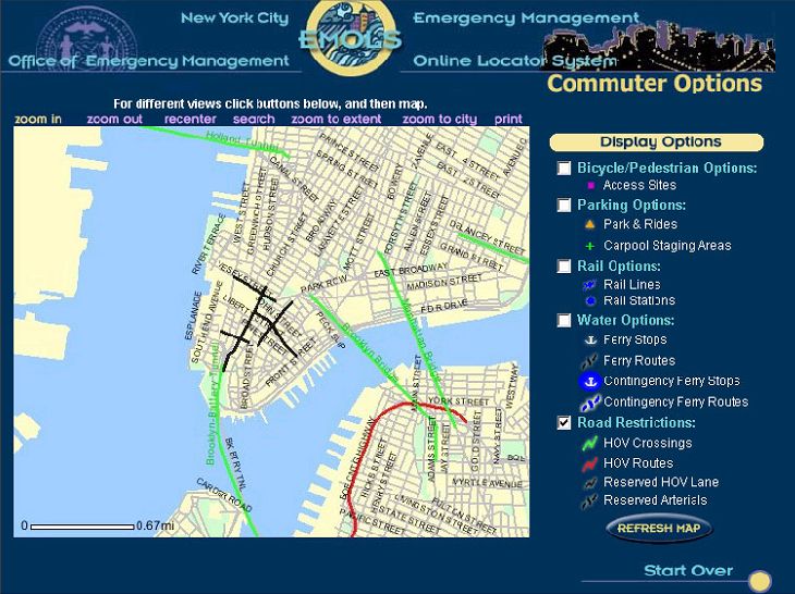
“New York City averted a public transit strike recently, saving commuters and residents a metropolitan-size headache of getting around. But if it had come to that, the city was ready to help idle people find their way.
A week before the scheduled strike, the city’s Office of Emergency Management, the Department of Information Technology and Telecommunications, and Frankfort, Ky.-based PlanGraphics Inc. designed and developed an interactive online map that enabled users to view various alternative transportation options and vehicular restrictions.
The application, which took about a half-day to design and a week to develop, was activated from Friday evening, Dec. 13, to Monday noon, Dec. 16, the deadline for the strike, said Mike Wiley, a project manager for PlanGraphics in New York City. During that time, users viewed more than 70,000 custom maps with a peak of about 6,000 maps served up Sunday evening. Although the application was subsequently deactivated, it’s available should a similar situation occur in the future.
The system can highlight bicycle and pedestrian access sites, carpool staging areas, rail lines and stations, ferry stops and routes, including contingencies, as well as carpool-only routes and other road restrictions.
The application is based on the city’s Emergency Management Online Locator System, which allows New Yorkers to find hurricane evacuation routes or cooling centers during a heat wave.
PlanGraphics, which has a seven-year working relationship with the city, also helped develop an online map of the area around the World Trade Center shortly after the Sept. 11, 2001, terrorist attacks. Sometimes twice daily, the company or the city would update what areas were accessible by motor vehicles or pedestrians in the area and provide other information.
The company is also planning to update the city’s “My Neighborhood Statistics” application, which allows users to view 14 selected performance statistics about their community, such as air and noise complaints, structural fires, infant mortality, clean sidewalks, felonies and certified teachers. By the end of January, the system, which went live in September 2002, will show 80 different metrics.
The city also recently awarded PlanGraphics a three-year, $15.4 million contract to continue to develop and upgrade the city’s GIS data repository, and provide greater access as well as more customized applications for the public and city agencies.”
Other non-interactive maps were posted, but the site vanished from the Web as quickly as it was posted.
MapQuest has driving instructions, Staphangers .org used to have a working subway route finder, and the Department of Transportation has PDF of NYC bicycle routes, but I’ve not found anything that ties together NYC’s many transportation alternatives into one online application.
In a struggle that shook the City, the Transport Workers Union stood up to the Mayor’s intimidation and successfully fought cuts. They also pushed the City into developing the most comprehensive New York City route finder I’ve seen. The screen shots I found indicate that the target audience were those who work in lower Manhattan and Wall Street, but such a tool would be useful for everyone — and would indicate which neighborhoods are underserved. I hope they put it back online, with subway and bus info added.
Update, 9/12/2003: The lack of a integrated route finding system in NYC has prompted one New York City resident to build his own. It needs work, but integrates bus and subway connections quite nicely.