

14 January 2011
Way of the Gun.
A quick state-level map and statistical analysis on gun violence in the US reveals some interesting correlations: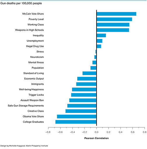
I’d love to see if a finer-grained city or census tract correlation bear out these findings, as well as other factors like, say, the scale of gun ownership.
![]() 14 January 2011, 7:51 AM | LINK | Filed in
information design, mapping, state of the union
14 January 2011, 7:51 AM | LINK | Filed in
information design, mapping, state of the union
Read more items related by tag: